|
View: 12605|Reply: 27
|
RazakSAT sudah di orbit - Upd8 : RazakSAT sudah rosak
[Copy link]
|
|
|
Post Last Edit by naen at 29-10-2011 01:36
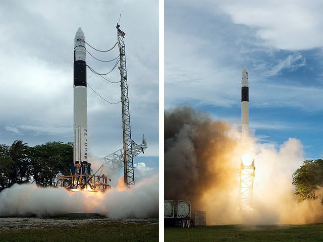
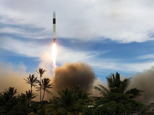
PETALING JAYA: Malaysia launched the RazakSAT, its second remotesensing satellite at Kwajalein Atoll, in the Marshall Islands at11.35am yesterday.
The 180kg satellite became the first of itskind in the world to enter the Near Equatorial Orbit (NEqO) directly 20minutes after its launch.
Science, Technology and InnovationMinister Datuk Dr Maximus Ongkili, Astronautic Technology (M) Sdn Bhd(ATSB) staff members and other senior ministry officials witnessed theevent at Guam via webcasting.
At the same time, deputy ministerFadillah Yusof and other agencies watched the launch from the NationalSpace Centre in Banting and communicated with the delegation in Guamusing teleconferencing.
The satellite, named after second PrimeMinister Tun Abdul Razak, was launched despite a slight drizzle andstrong winds at the launching site.
Dr Maximus said the satellite covered 70% of the ocean where weather phenomena such as La Nina could be observed.
Headded that several countries in Asia, Africa and Latin America hadexpressed their interest in using the images produced by RazakSAT.
Thesatellite will be controlled from the Mission Control Station and ImageReceiving and Processing Station in Malaysia. ATSB engineers will beconducting missions, command generation, telemetry receiving, archivingand analysis from the Mission Control Station.
kopi/pes - http://thestar.com.my/news/story ... ion/4322566&sec=nation |
|
|
|
|
|
|
|
|
|
|
|
so Padlie,
yang ni satelit komunikasi ker or satellite yg boleh guna untuk tujuan research like climate , ocean etc etc? |
|
|
|
|
|
|
|
|
|
|
|
razaksat is a earth observation satellite.. utk remote sensing.
same mcm tiungsat gak |
|
|
|
|
|
|
|
|
|
|
|
3# chuckiey
remote sensing in terms of capturing any earthly phenomena lah yer , gitu? |
|
|
|
|
|
|
|
|
|
|
|
senang cerita imej dia macam Google Earth la..
resolusi dia 2.5m panchromatic, 5m multispectral.
Kelebihan dia sebab kita launch dia kat Neqo, dia pass negara kita lebih kurang 15 kali sehari. Setiap lebih kurang sejam 40 minit. Imaging chance pun tinggi. Berbanding kalau kita launch di SSO, kita dapat 2 pass je sehari. |
|
|
|
|
|
|
|
|
|
|
|
oh tadi baru baca tentang RAZAK SAT ni yes ... this satellite is positioned at NeqO yep....oh ini mmg buatan Malaysia yer ? cayalah....
dan more on bio- tech based application bagus bagus |
|
|
|
|
|
|
|
|
|
|
|
6# padlie
Tadi baru terbaca tentang satelit ini kat MEGA - oh rupa rupanya ini adalah satelit pertama yg the first of its kind being positioned at this so called NEQO? |
|
|
|
|
|
|
|
|
|
|
|
|
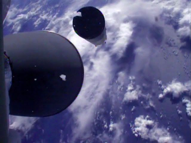
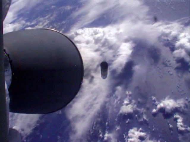
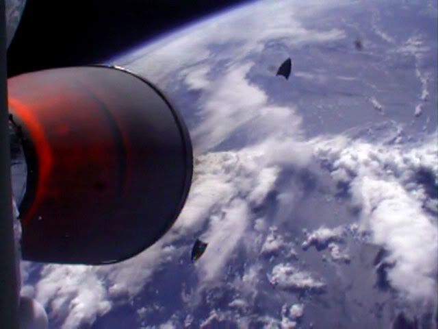
kecik je roket dia ek? tinggi pokok kelapa je. amazing pics... SPACEX ni private company je.. kat US skrg rocket launch dah dibuat oleh private companies je, gomen US dah mula let go. |
|
|
|
|
|
|
|
|
|
|
|
senang cerita imej dia macam Google Earth la..
resolusi dia 2.5m panchromatic, 5m multispectral.
Kelebihan dia sebab kita launch dia kat Neqo, dia pass negara kita lebih kurang 15 kali sehari. Se ...
padlie Post at 19-7-2009 08:17 
dia punyer instrumentation on board tu, optical imaging kat visible light spectrum saja jer ker atau infrared sekali? |
|
|
|
|
|
|
|
|
|
|
|
8# mbhcsf
yup, disebabkan orbit ni dalam masa 10 hari ni dah dapat more than 100 passes. dibandingkan kalau SSO, hanya dalam 40 passes.. |
|
|
|
|
|
|
|
|
|
|
|
10# cmf_aishiteru
payload dia medium aperture camera - visible light spectrum |
|
|
|
|
|
|
|
|
|
|
|
|
cite pasal satellite ni, nk tanye sikit ar, cam ne satellite ni leh stay kt orbit die ha? |
|
|
|
|
|
|
|
|
|
|
|
|
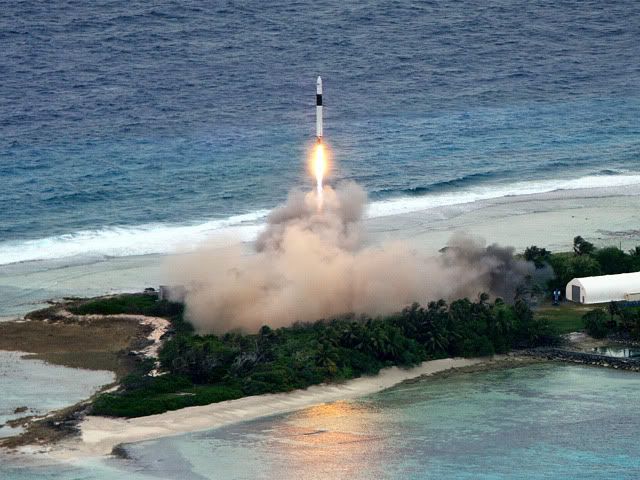
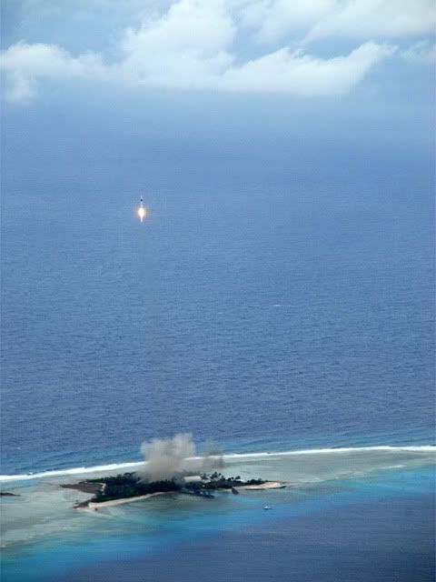
tapak pelancaran dier kat pulau yer..lawa gak pulau tu.. |
|
|
|
|
|
|
|
|
|
|
|
14# cloud_sparda
It's a tough question to answer but a good one though. The simplest answer would be that most satellites maintain its attitude by thruster. I'm not an aeronautical engineer so I cannot give you any satisfying answer. If you are very curious about it, there are plenty of resources available online. Be warned you need a substantially good understanding of orbital mechanics, space flight and gravity in order to understand some of those materials. Good Luck! |
|
|
|
|
|
|
|
|
|
|
|
|
dah ada contoh data imej dari razaksat tak? |
|
|
|
|
|
|
|
|
|
|
|
14# cloud_sparda
Soalan ni perlukan penjelasan yang sangat detail. Saya just cerita ringkas disini.
Konsep dia seperti awak membaling batu ke hadapan. Semakin kuat tenaga yang kita gunakan, semakin jauh batu tu terlontar ke hadapan sebelum jatuh ke bumi. Bila kita lontarkan batu tu dengan tenaga yang yang cukup kuat, ia mampu mengelilingi bumi sebelum jatuh ke tanah (of course tenaga manusia tak boleh buat perkara ni). Kita boleh bayangkankan satelit ni sebagai objek yang dilontar dengan sangat laju di paras ratusan kilometer. Ia akan mengelilingi bumi ratusan kali tetapi secara perlahan-lahan masih jatuh ke bumi. Jatuhan yang disebabkan drag ni adalah sangat perlahan kerana keadaan mikrograviti. Boleh try benda kat sini -> http://www.mcasco.com/p1aso.html
Untuk mengekalkan ketinggian satelit di orbitnya, semua satelit dilengkapi dengan subsistem yang dinamakan Attitude Determination and Control System (ADCS). ADCS ni melibatkan komponen seperti thruster, magnetometer, magnetorquer, reaction wheel, star sensor, sun sensor dan sebagainya. Hanya satelit besar yang gunakan thruster kerana thruster ni berat, begitu juga bahanapi dia. Lebih berat satelit, lebih mahal kosnya. Satelit kecil hanya perlukan komponen lain yang disebutkan tadi.
Semakin tinggi satelit semakin lambat penurunan altitudnya. Satelit yang berada di altitud 300 km lebih mudah ditarik ke bumi. Contohnya ISS perlu di 'tolak' kembali ke altitud asalnya oleh soyuz, shuttle dan progress setiap kali kapal kapal-kapal angkasa ni bercantum dengannya. |
|
|
|
|
|
|
|
|
|
|
|
17# actza
imej pertama diperolehi pada 20 Julai lepas. Imej-imej yang ada tak boleh disebarkan. |
|
|
|
|
|
|
|
|
|
|
|
18# padlie
props to you for the keeping the explanation simple and str8 forward
do you by any chance working for RAZAKsat? |
|
|
|
|
|
|
|
|
|
| |
Category: Belia & Informasi
|


 Post time 15-7-2009 04:51 PM
 变色卡
变色卡 Author