|
|
- P L A C E S _ I N _ S ' P O R E - HortPark
[Copy link]
|
|
|
sc takut dgn cicak ghupernya
jauh dia lari.....walaupon cicak ni mati liao 
 |
|
|
|
|
|
|
|
|
|
|
|
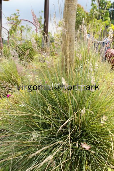
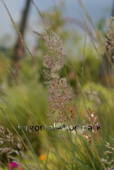
ni lalang ek... lawa biler dkt
[ Last edited by virgomal at 14-4-2008 02:40 PM ] |
|
|
|
|
|
|
|
|
|
|
|
tangan pong ada munger 
[ Last edited by virgomal at 14-4-2008 02:39 PM ] |
|
|
|
|
|
|
|
|
|
|
|
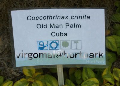 n
namanya....
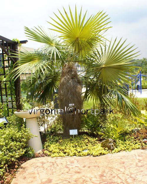
pokoknya....
|
|
|
|
|
|
|
|
|
|
|
|
Reply #82 virgomal's post
|
|
|
|
|
|
|
|
|
|
|
masa kat kampung macam tau nama daun ni...
lah ni tak ingat dah  |
|
|
|
|
|
|
|
|
|
|
|
ada baby cot kat dlm park  |
|
|
|
|
|
|
|
|
|
|
|
PM Lee opens new pedestrian bridges and Hort Park at Southern Ridges
By Wong Siew Ying, Channel NewsAsia | Posted: 10 May 2008 1826 hrs

SINGAPORE: You can now take a 9-kilometre walk from Mount Faber to Telok Blangah Hill and Kent Ridge Park. The three hills are collectively known as the Southern Ridges and they are linked by two new pedestrian bridges and a walkway, which were opened on Saturday by Prime Minister Lee Hsien Loong.
PM Lee said the Southern Ridges is part of the country's effort to transform itself into a city of gardens and water.
As Singapore's economy and population continues to grow, Mr Lee assured that the government will strive to provide the highest quality of life possible for all residents.
PM Lee said: "I think quite a lot of Singaporeans worry that our quality of life will suffer, that there won't be enough space for all of us. And they ask, 揑s our little island getting too crowded, will we lose our sense of comfort of space and greenery? |
|
|
|
|
|
|
|
|
|
|
|
related news...
Three new linkways at Southern Ridges cost S$25.5m
By Wong Siew Ying, Channel NewsAsia | Posted: 10 May 2008 1911 hrs

SINGAPORE: The three new linkways at the Southern Ridges cost the Urban Redevelopment Authority S$25.5 million to build.
To enjoy the view on foot, one must be prepared to spend at least two and half hours to cover the entire attraction. Harbour views in the day and city lights at night are some of the sights one can enjoy while strolling along the Henderson Waves bridge.
At a height of 36 metres or 12 storeys from the road, it's the highest pedestrian bridge in Singapore. The 300-metre bridge links up the parks at Mount Faber and Telok Blangah Hill.
The bridge is constructed using steel and all-weather timber which can be found in Southeast Asia. As a lot of wood was used in the decking, the National Parks Board (NParks), which is maintaining the structure, said smoking will be prohibited for safety reasons.
Beyond the Henderson Waves Bridge and a one-kilometre hilltop walk, you also get to experience the meandering forest walk and earth trails. But NParks assures that these are harmless.
The 1.3 kilometre raised walkway, with heights ranging from three to 18 metres, brushes the canopy of the secondary forest of Telok Blangah Hill.
And NParks said the trees are inspected regularly. It has also made sure that there are no overhanging branches over the forest walk.
While this will help prevent visitors from being hurt by fallen branches, NParks hopes people can be responsible for their own safety and avoid the trail during thunderstorms.
It's also keeping an eye on security.
Kong Yit San, Director, Parks, NParks, said: "We do have interconnecting staircases, exits and entrances clearly marked, while the forest walk goes through a secondary forest. It's also quite near to HDB areas and certain residences. So we don't feel that there is a high security concern. But nevertheless, this is a new thing, we will be sending so-called maintenance crew on a daily basis to check out in case some naughty kids (who) decide to mess with it (or) add something to it. Just challenge us in maintenance."
According to NParks, the other new bridge, the Alexandra Arch will be easier to maintain.
It spreads out like an opened leaf over Alexandra Road and will lead visitors to Hort Park and on to Kent Ridge Park.
To commemorate the event, the Monetary Authority of Singapore has launched the Singapore Identity Plan (Southern Ridges) Coin.
These limited collections will be sold by the Singapore Mint. - CNA/vm |
|
|
|
|
|
|
|
|
|
|
|
The Sunday Times
May 11, 2008
Newly opened bridges link parks along Southern Ridge together
By Teo Cheng Wee

Henderson Waves (above), at a height of 36m, is Singapore's highest pedestrian bridge. -- ST PHOTO: ASHLEIGH SIM
THE wet morning on Saturday did not dampen the excitement of Telok Blangah resident Habib Ismail.
He was among 500 residents who watched Prime Minister Lee Hsien Loong officially open two pedestrian bridges - Henderson Waves and Alexandra Arch.
With these bridges, Telok Blangah Hill Park is now linked to Mount Faber on one side and Kent Ridge Park on the other.
An avid walker, Mr Habib, 44, a father of two, then joined Mr Lee and the other residents on a tour of the bridges.
The bridges complete a 9km chain of greenery in the Southern Ridges, which consist primarily of three large hill parks - Mount Faber, Telok Blangah Hill Park and Kent Ridge Park.
Henderson Waves, at a height of 36m, is Singapore's highest pedestrian bridge. A wave-shaped, steel-and-timber structure, it spans 274 metres across Henderson Road.
The other bridge is Alexandra Arch, which spans 80 m across Alexandra Road.
The parks were previously separated by roads and wooded vegetation. Now one can walk ridge-to-ridge, starting from Harbourfront MRT and ending at West Coast Park.
In 2002, the Urban Redevelopment Authority (URA) said it will link up parks in the Southern Ridges, as part of the Parks and Waterbodies and Identity Plan.
The project, which took two years to complete, cost the URA $25.5 million.
Apart from the two bridges, the Southern Ridges now also boast the Forest Walk, a 1.3km-long elevated walkway that cuts through secondary forest at Telok Blangah Hill Park; and Marang Trail, which links Harbourfront MRT to Mount Faber.
PM Lee also officiated the opening of the $13 million Horticulture Park - or HortPark for short.
With 20 theme gardens, HortPark is Southeast Asia's first one-stop gardening and lifestyle hub.
The 23ha park, which has been open since December last year, took 2 years to build and also serves as a park connector between Telo Blangah Hill Park and Kent Ridge Park
In his speech, Mr Lee noted that such projects "provide a first-class environment for all Singaporean".
He also announced upcoming plans to link the Southern Ridges to the Keppel Waterfront as part of a broader plan to develop a recreational a leisure hub in the south.
This include having a park connector from Alexandra Arch to Labrador Park, building a mangrove boardwalk at Berlayer Creek a having a waterfront boardwalk that connects Bukit Chermin to VivoCity, with waterfront views along the entire stretch of Keppel Bay.
Details of these plans will be released soon, the URA said.
About 1 million visitors to the Southern Ridges are expected annually, and with the bridges open 24 hours a day, lovebirds might be expected to make a beeline for them after dark, especially as Henderson Waves offers panoramic views of the city and southern islands.
Mr Habib, a senior research supervisor, had stopped his daily jogs at Telok Blangah Hill Park due to work commitments. He is digging out his sneakers again.
"I'm making plans to walk along the new walk with friends," he said with a smile. |
|
|
|
|
|
|
|
|
|
|
|
May 14, 2008
Direct link from Alexandra Rd to Keppel Bay to be built
By Liaw Wy-Cin
IN three years, nature lovers will be able to trek 2.2km directly from Alexandra Road to the southern Keppel waterfront, cutting through garden paths and mangrove swamps along the way.
The more adventurous ones can take another 6km trail along the waterfront, and get to the hills in the Mount Faber and Telok Blangah areas.
Altogether, this 8km loop connecting hills in the Southern Ridges to the southern Keppel waterfront is part of a 2002 plan by the Urban Redevelopment Authority to create more parks and waterbodies in Singapore.
The URA on Wednesday announced the details of the 2.2km walkway, which it called the Labrador Nature and Coastal Walk.
Prime Minister Lee Hsien Loong last Saturday announced the development of the walkway when he opened two pedestrian bridges linking hills in the Southern Ridges.
The 9km-long Southern Ridges consist primarily of three large hill parks - Mount Faber, Telok Blangah Hill Park and Kent Ridge Park.
The 2.2km walkway will start with a garden trail at Alexandra Road, where the newly opened Alexandra Arch is. More shrubs will be planted, and cycling paths and more footpaths will be built.
The path then continues into the Berlayer Creek mangrove swamps, currently not accessible to the public. A boardwalk will be built along the banks of the swamps and information boards about flora and fauna in the area will be put up.
The pathway finally opens out into the sea, with a boardwalk connecting Labrador Park to the future promenade of the Reflections at Keppel Bay condominium.
With the condominium and the Labrador Park MRT station also expected to be completed by 2011, that southern area, together with existing nearby recreational areas, such as Gillman Village and Vivocity, is expected to generate more buzz, said Mr Ler Seng Ann, director of URA's conservation and development services.
With the completion of the 2.2km walkway, more areas of Singapore's land and coastline will be made accessible to the public, he said.
The 2.2km walkway is estimated to cost $10 million and construction will begin next year. |
|
|
|
|
|
|
|
|
|
|
|
URA announces plans for new leisure destination
By Hasnita A Majid, Channel NewsAsia | Posted: 18 May 2008 2227 hrs

Mr Ler Seng Ann
SINGAPORE: In just three years, Singaporeans will be able to enjoy a new attraction in the southern part of Singapore as the Urban Redevelopment Authority (URA) plans to develop the area around Alexandra and Labrador Park into a recreational and leisure hub.
Berlayer Creek is a place where you can find mangrove swamps and exotic birds. But not many people are aware of the natural treasures available there.
With few amenities, access to the place is near impossible, but this is set to change in the next few years.
A mangrove trail, called the Berlayer Creek Mangrove Trail, will be built, complete with lookout points, a plaza and a boardwalk.
Ler Seng Ann, director of Conservation & Development Services, URA, said: "The construction will be carried out carefully such that the eco-system will not be affected."
The Urban Redevelopment Authority will also be sprucing up a stretch of area along the eastern bank of Alexandra Road, between Depot Road and Telok Blangah Road.
The 830-metre stretch |
|
|
|
|
|
|
|
|
|
|
|
Leisure Plan drawn up to enhance recreational options in Singapore
By Wong Siew Ying, Channel NewsAsia | Posted: 21 May 2008 2135 hrs

Overview of Gardens by the Bay site

SINGAPORE: In the near future, one will be able to stroll, jog or cycle around the whole of Singapore just by following an extensive route.
The Urban Redevelopment Authority (URA) is developing a 150-kilometre round-island path as part of its Leisure Plan.
National Development Minister Mah Bow Tan revealed details of new recreational options at the Architectural Design Awards 2008 ceremony on Wednesday.
The round-island route will be developed over the next 10 to 15 years, but up to two-thirds of the path |
|
|
|
|
|
|
|
|
|
|
|
from Straits Times
May 21, 2008
URA unveils new island-wide leisure plan

The plan will also create more leisure destinations with unique offerings for Singaporeans and tourists. -- PHOTOS: URA

The Leisure Plan is part of the draft masterplan 2008 to sustain economic growth and enhance the quality of living environment for Singapore.
A NEW island-wide leisure plan that showcases a diverse range of leisure opportunities for all to enjoy, from vibrant and exciting activities to the quiet retreats, was unveiled by National Development Minister Mah Bow Tan on Wednesday night.
Besides new green spaces, the Leisure Plan presents a whole host of other recreational options, from more upcoming water activities in selected rivers and reservoirs across the island, new sporting facilities close to homes, to lifestyle hotspots and many things to do in the city.
Mr Mah highlighted details of the plans in his keynote address to the Singapore Institute of Architects 47th annual dinner at the Suntec Convention Centre Ballroom before an audience of 1,000 architects and industry players.
The Leisure Plan is part of the draft masterplan 2008 to sustain economic growth and enhance the quality of living environment for Singapore.
The ideas and opportunities in the new plan show how Singapore can further enhance its living environment by making the most of its assets, capitalising on its unique identity and heightening the sense of greenery, said a statement from the Urban Redevelopment Authority on Friday.
The Leisure Plan builds on the previous Parks and Waterbodies and Identity Plans developed by URA in 2003.
Since then, many of the proposals in these plans have been implemented.
'This is the first time that an island-wide plan has been drawn up to showcase greater variety and quality of recreational choices round-the-clock, island-wide, for people of all ages,' said the URA.
'Besides new green spaces, the Leisure Plan presents a whole host of other recreational options, from more upcoming water activities in selected rivers and reservoirs across the island, new sporting facilities close to homes, to lifestyle hotspots and many things to do in the city.'
Key highlights of the Leisure Plan:
The existing park connector network will be tripled from 100 km today to 360 km.
A first-ever 150-km round-island route for people to stroll, jog or cycle around the entire country. Park connector network will be expanded with seven loops and five links. More park spaces will be added - from about 3,300 hectares today to 4,200 hectares, offering a greater variety of experiences for all.
The plan will also create more leisure destinations with unique offerings for Singaporeans and tourists.
For example, the Kranji and Lim Chu Kang area will become a unique countryside destination close to nature. There will be new park lands and agritainment attractions, enhancements to existing attractions, such as the Sungei Buloh and Kranji Reservoir, and greater access to the nature areas, the waterfront and the farms.
To add greater buzz and nightlife in the city, more programmes will be developed especially in Orchard Road, Singapore River, Bras Basah. Bugis and Marina Bay.
There will be night festivals coming up like the Singapore River Festival organised by the Singapore Tourism Board, starting in September this year. The National Heritage Board is also developing a Night Festival in the Bras Basah and Stamford Road area over two weekends in July.
There will be a weekend street theatre, live music, dance performances and interactive programmes. This will position the precinct as a venue for large-scale night events and create synergy between existing developments such as the Stamford Green, National Museum and SMU.
'The Plan will provide for both active and passive recreation. We have also come up with new ideas on how to create a 24/7 city,' said Mrs Cheong Koon Hean, URA's Chief Executive Officer.
'It is not just about providing space and facilities to play, it is also enhancing the variety and quality of leisure options we have round-the-clock, where there is something for everyone.' |
|
|
|
|
|
|
|
|
|
|
|
Travel company plants 200 trees at Jurong Central Park
By Margaret Perry, Channel NewsAsia | Posted: 21 May 2008 2304 hrs

SINGAPORE : Residents in Jurong West now have their own central park.
South West District Mayor, Dr Amy Khor, was at Jurong Central Park on Wednesday to help 30 staff from travel company Abacus International plant 200 native trees.
The event launched the company's efforts to help the environment by cutting carbon emissions.
It is also part of the Plant-A-Tree programme by the Singapore Environment Council and the Garden City Fund, a fund-raising arm of the National Parks Board.
It also ties in with the South West Community Development Council's aim to plant 100,000 native plants. - CNA/ms |
|
|
|
|
|
|
|
|
|
|
|
Sungei Buloh Wetland Reserve to undergo expansion
By Valarie Tan, CNA, posted 6 Dec 2009, 1614hrs

Sungai Buluh Wetland Reserve
SINGAPORE: One of Singapore's largest wetland reserves is set to undergo a revamp in the next five years.
A draft masterplan was launched on Saturday to expand the 130-hectare Sungei Buloh Wetland Reserve. There will also be rooms for nature experts to conduct research.
Shutterbugs and nature lovers often hang out at the Sungei Buloh Wetland Reserve in northern Singapore.
So do 220 species of birds, including rare ones like the Nordmann's Greenshank, which breeds in Siberia, and migratory shorebirds which use the reserve as a stopover.
The Sungei Buloh Wetland Reserve celebrated its 15th anniversary on Saturday by launching the grand expansion plan.
"We should not let the crisis take the wind out of our celebration.....This draft masterplan will ensure that the core of the nature reserve is conserved for its biodiversity values, while the fringes are enhanced for nature learning and recreation," said Senior Minister Goh Chok Tong.
The plan is to link the current reserve to at least three other mangroves, reservoirs and marshes in the nearby Lim Chu Kang and Kranji areas.
It will also be broken up into different zones to cater to different visitors, such as a wetland playground for children and restricted areas for researchers only.
NParks says the cost of the project will depend on the finalised masterplan, which is expected to be ready by the end of 2009.
Construction will start a year later and is expected to be completed by early 2013.
Sungei Buloh Nature Reserve is Singapore's first ASEAN Heritage Park.
Since 1998, the nature reserve has welcomed some 100,000 local and overseas visitors each year.
- CNA/ir |
|
|
|
|
|
|
|
|
|
|
|
|
kasi topik ni naik atas.. more pics & laporan..;) |
|
|
|
|
|
|
|
|
|
|
|
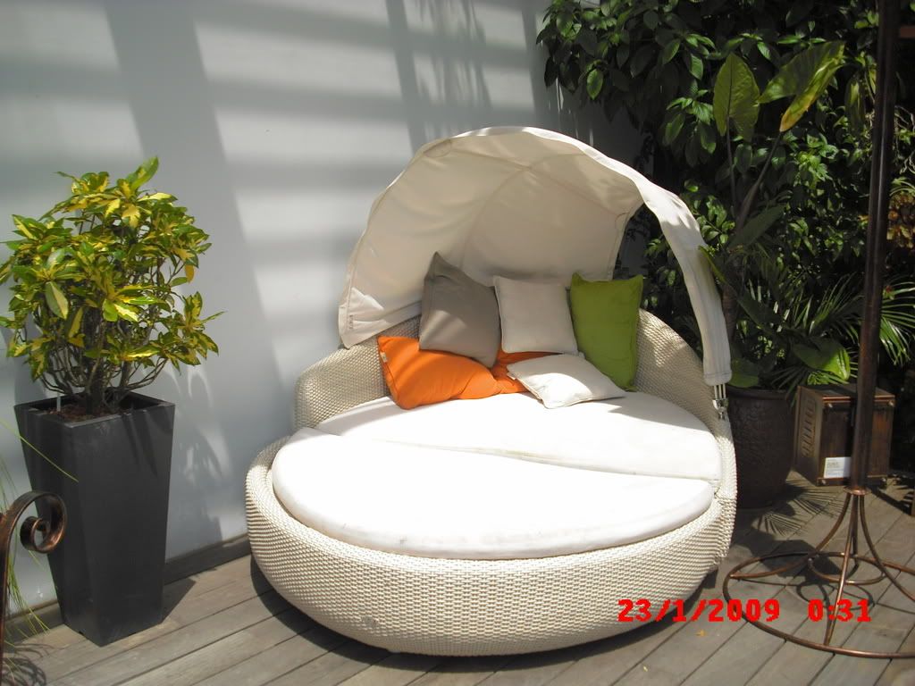
smlm seperti biasa, kita ke hortpark.. bnyk benda yg menarik sempena tahun baru cina ni.. yuk yuk kita layan gambar..;)
 |
|
|
|
|
|
|
|
|
|
|
|
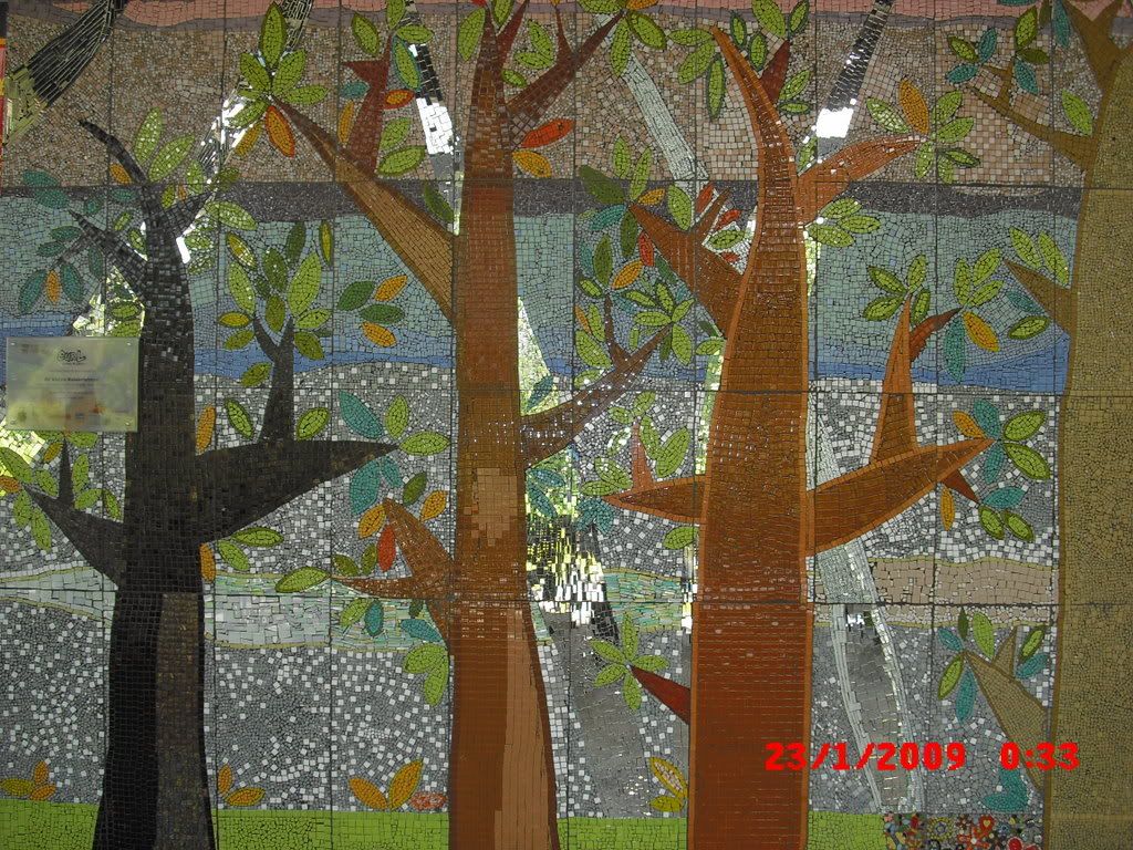
kepingan cermin empat segi dicat.
 |
|
|
|
|
|
|
|
|
|
| |
Category: Negeri & Negara
|